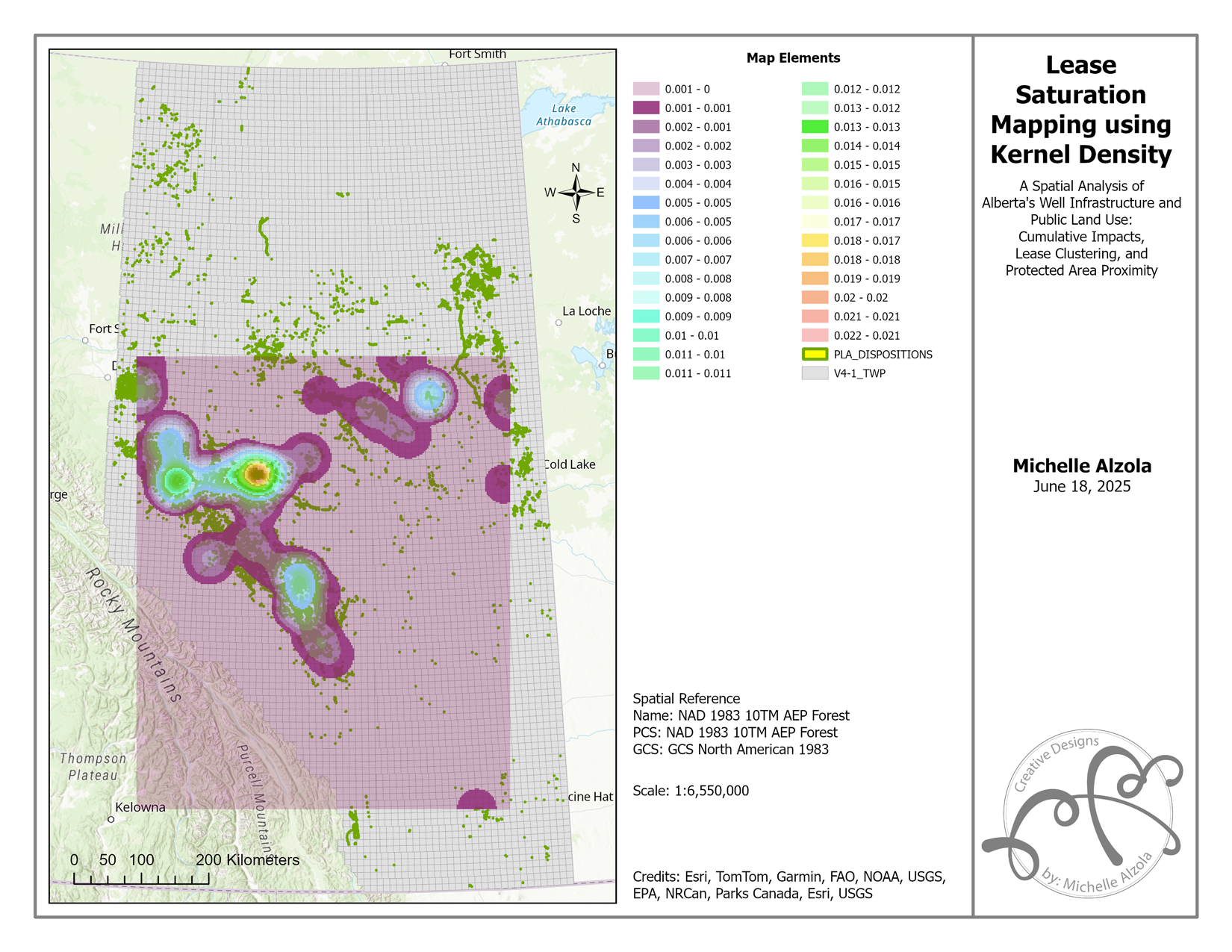
Introduction Alberta’s vast public lands serve a dual purpose: supporting industrial development and conserving ecological integrity. But what happens when the smaller, less-regulated leases—classified as “incidental activities”—start stacking up across the landscape? In this GIS portfolio project, I conducted a spatial analysis of Alberta’s oil and gas infrastructure, focusing on…
Category: Projects
Projects
Read more
Wildfire Risk Mapping in Alberta Using GIS: A Data-Driven Approach
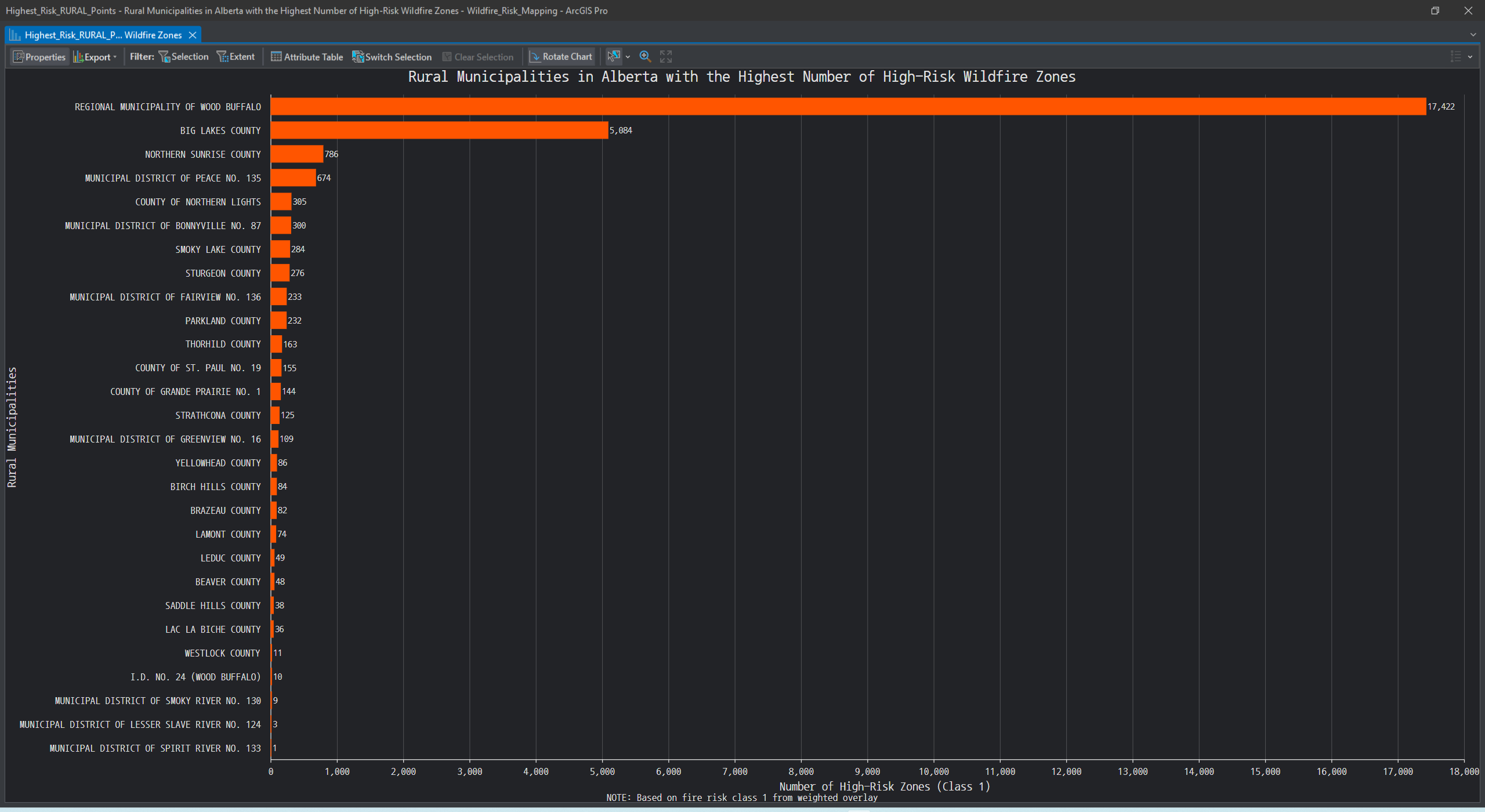
Project Summary In this project, I explored how GIS can be used to model and visualize wildfire susceptibility across Alberta. Using official datasets and ArcGIS Pro, I created a wildfire risk surface that highlights vulnerable regions—particularly those with steep slopes, coniferous vegetation, and proximity to recent wildfire activity. This study…