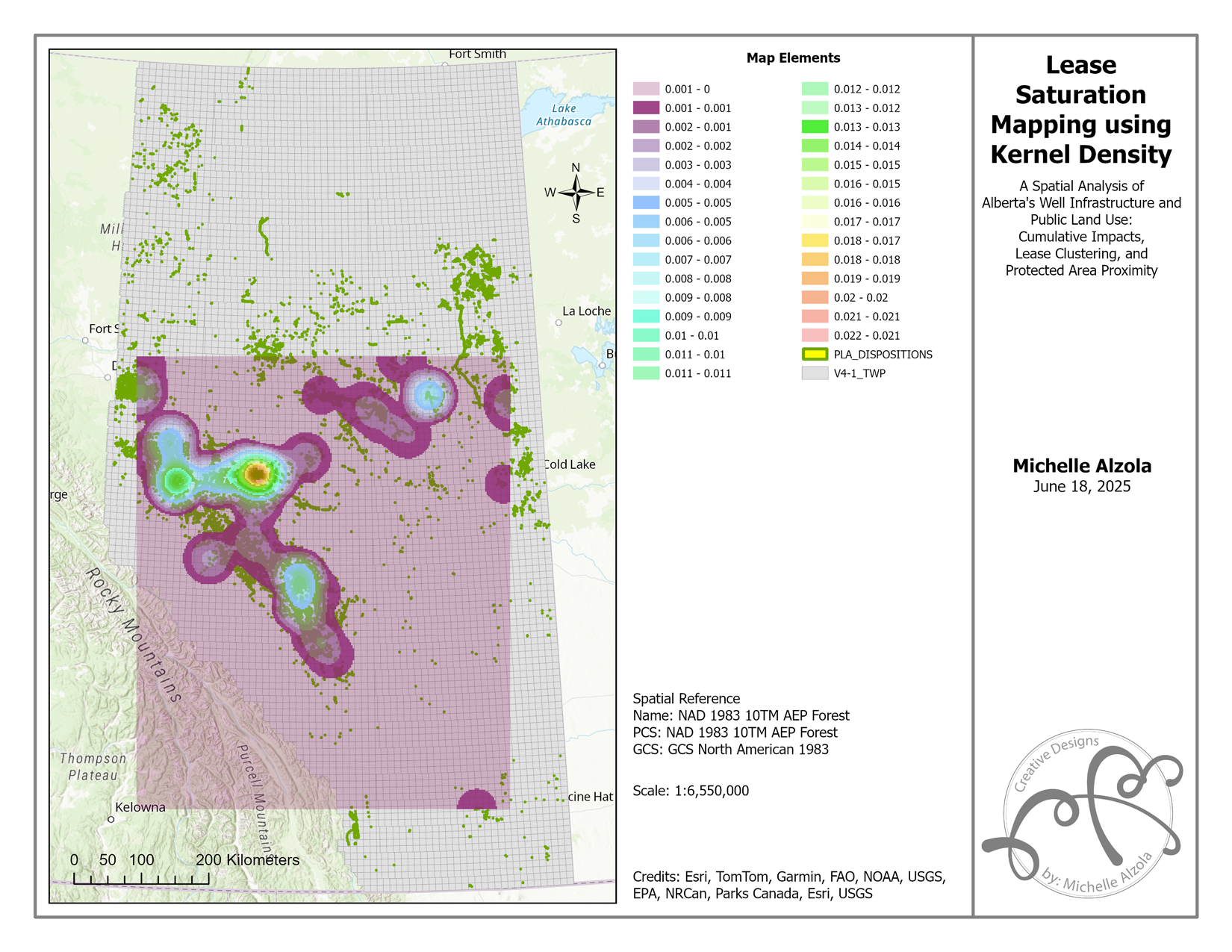
Introduction Alberta’s vast public lands serve a dual purpose: supporting industrial development and conserving ecological integrity. But what happens when the smaller, less-regulated leases—classified as “incidental activities”—start stacking up across the landscape? In this GIS portfolio project, I conducted a spatial analysis of Alberta’s oil and gas infrastructure, focusing on…
Projects
Read more
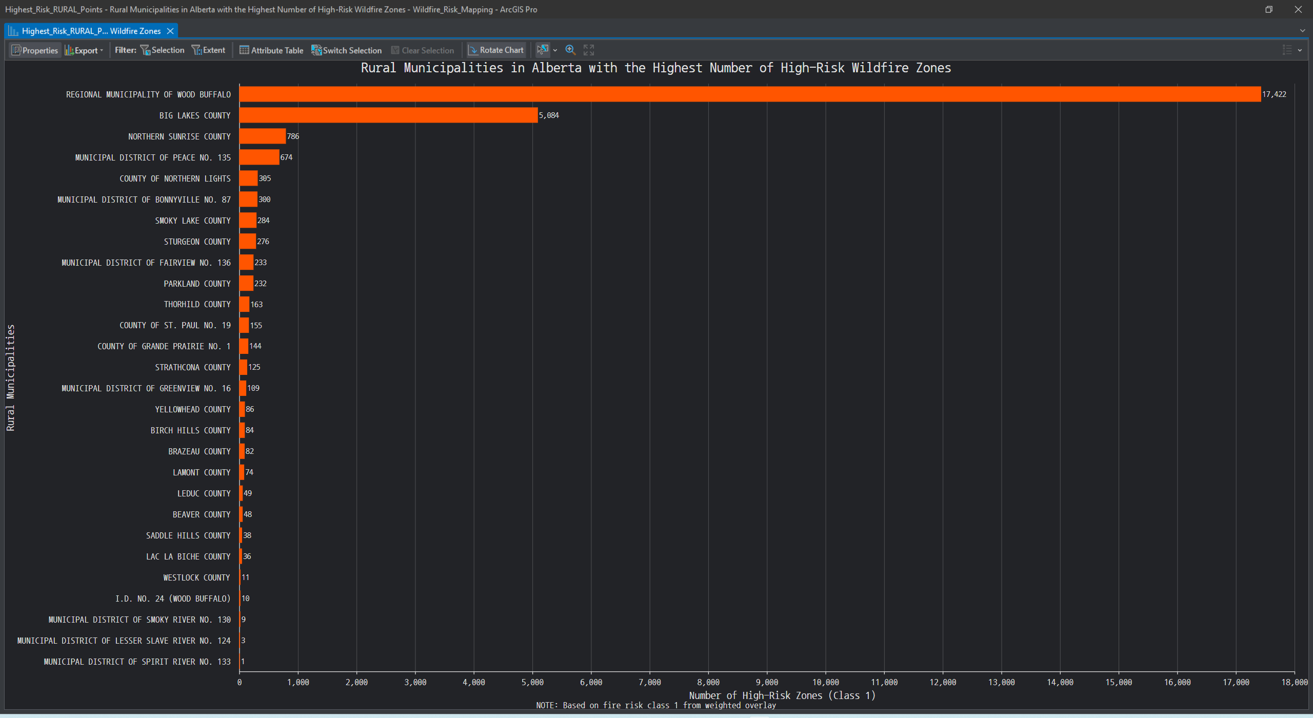
Wildfire Risk Mapping in Alberta Using GIS: A Data-Driven Approach
Project Summary In this project, I explored how GIS can be used to model and visualize wildfire susceptibility across Alberta. Using official datasets and ArcGIS Pro, I created a wildfire risk surface that highlights vulnerable regions—particularly those with steep slopes, coniferous vegetation, and proximity to recent wildfire activity. This study…
Coordinate Systems
Read more
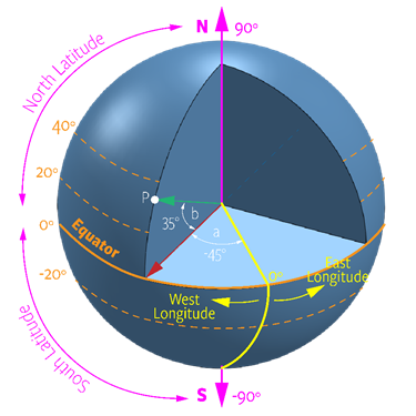
How Map Projections and Coordinate Systems Shape Geographic Data
The basic principle in Geographic Information Systems (GIS) is that all map layers must align spatially when used together (Chang, 2019). Spatial alignment ensures that information is accurate, meaningful, and not misleading. Below is a map displaying several layers of the city of Calgary, including district boundaries (City of Calgary,…